CONCRETE-LINED CHANNEL ASSESSMENT
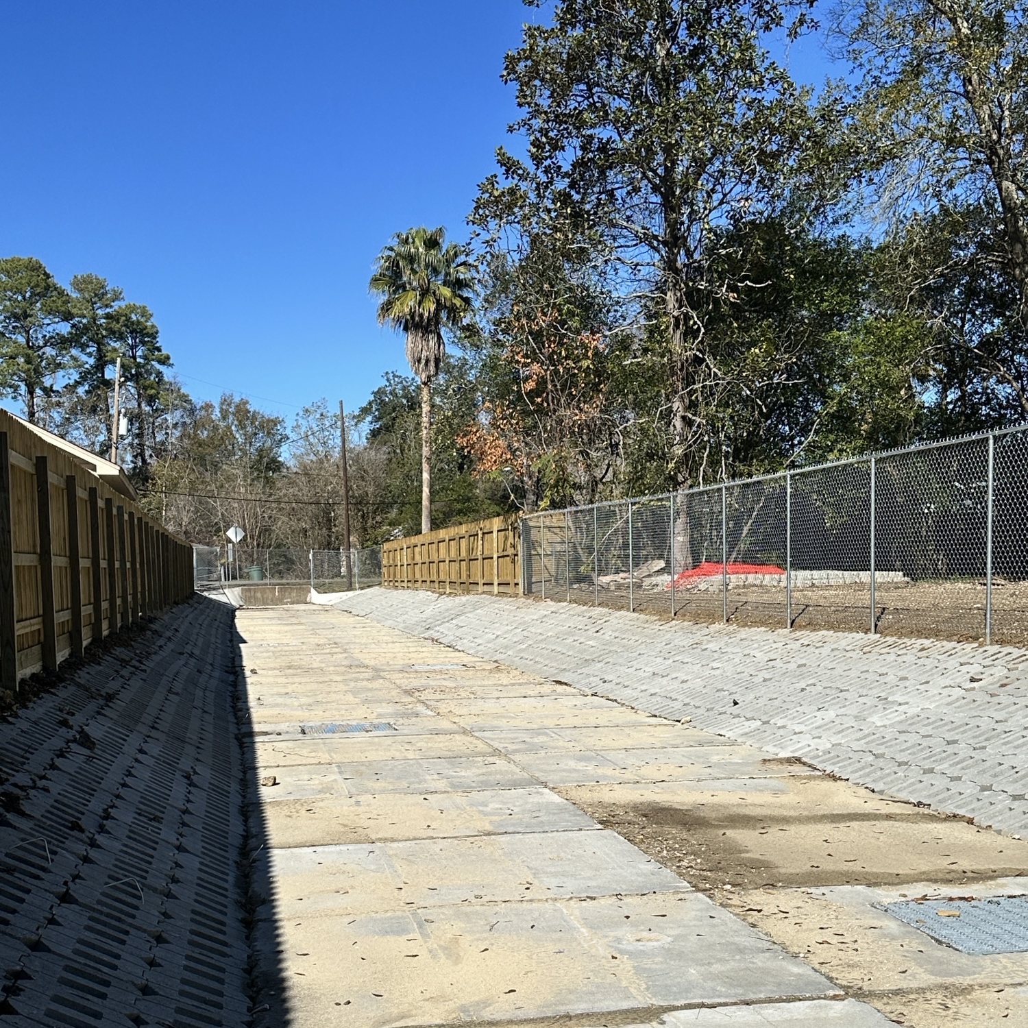
Perform a channel condition assessment for concrete-lined channels to determine the current conditions and the extent of the defects. Document deficiencies using a digital photograph with a GPS point. Provide a written description that includes a photograph number, deficiency location, measurements of the deficiency, methods of addressing the deficiencies, and other technical comments specific to the deficiency. This assessment will promote a long-term plan for future repairs and grant funding applications.
CONCRETE-LINED CHANNEL REPAIRS
As a result of the ongoing Concrete-Lined Channel Assessment Project, approximately $80M in structural deficiencies have been documented throughout the system. Repairs will be administered in a multi-phase approach beginning with the Concrete-Lined Channel Repairs – Phase 1 Project. This project will restore the structural integrity and lost hydraulic capacity of the District’s concrete-lined channels.
DD6 ADDITIONAL PARKING
Design and construct a parking lot at the District’s main facility. This project will provide 102 additional parking stalls and free up space in the District’s yard for the storage of equipment and materials.
DITCH 505 FANNETT DETENTION
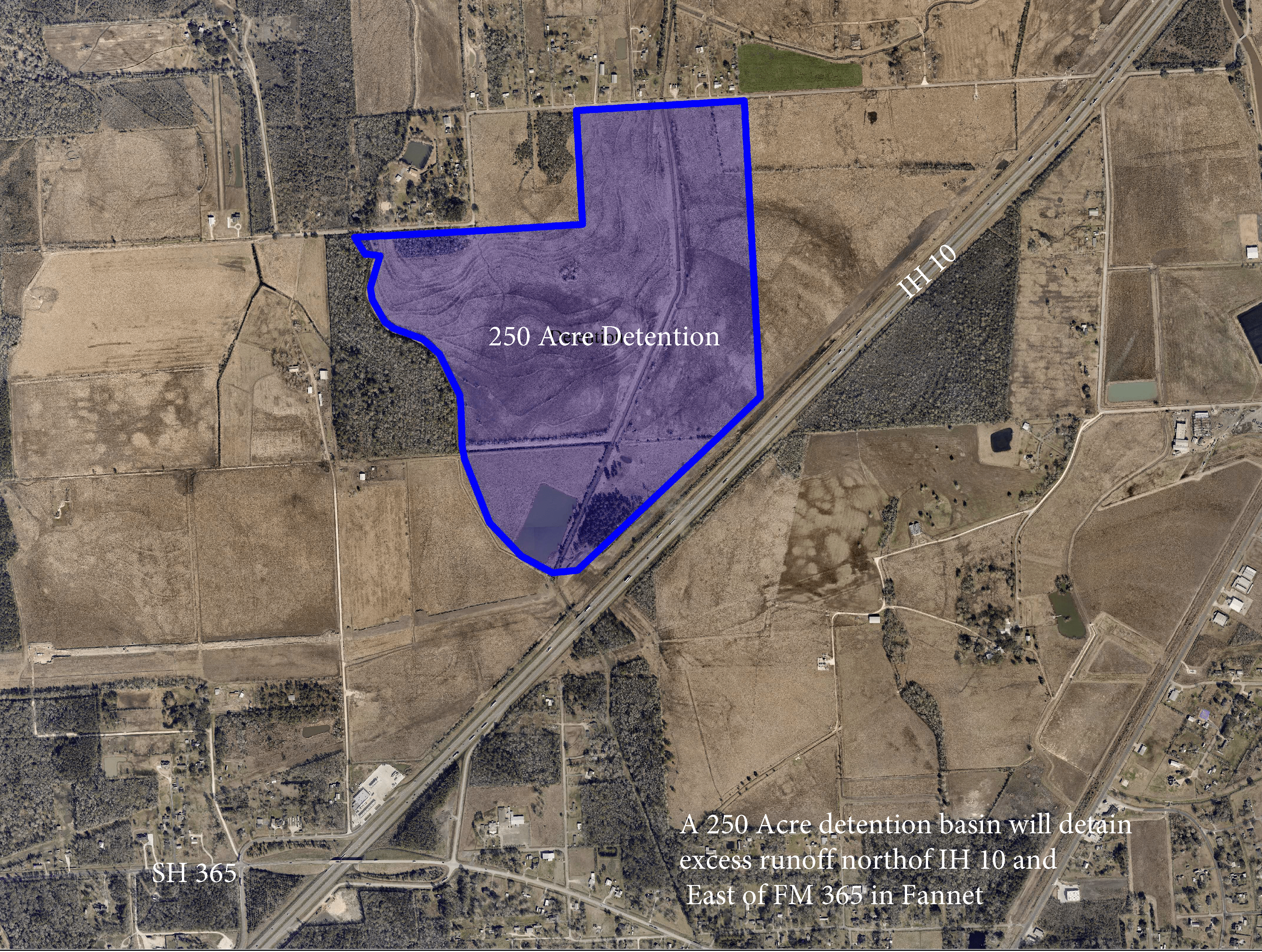
Acquire right-of-way (approximately 250 acres), design and construct a detention basin (approximately 1.7 million cubic yards of excavation) west of IH-10 at the confluence of Ditch 505 and 505-B. Provide flood relief to the Ditch 505 watershed and parts of Taylor’s Bayou.
EARTHEN CHANNEL ASSESSMENT
Perform a channel condition assessment for earthen channels to determine the current conditions and the extent of the defects. Document deficiencies using a digital photograph with a GPS point. Provide a written description that includes a photograph number, deficiency location, measurements of the deficiency, methods of addressing the deficiencies, and other technical comments specific to the deficiency. This assessment will promote a long-term plan for future repairs and grant funding applications.
FANNETT DETENTION BASIN
A 250 Acre detention basin will detain excess runoff north of IH 10 and East of FM 365 in Fannett.

GIWW BREAKWATER AT WHITE’S RANCH
Construct rock breakwater for erosion control along the north bank of the GIWW at each White’s Ranch outfalls to protect the shoreline and the outfall structures.
Briarcliff Channel Improvement
Improving drainage by removing crumbling concrete channel liner and replacement with new box culverts and concrete channel from Briarcliff Street to Delaware Street.

GREEN POND GULLY STUDY
GREEN POND GULLY STUDY
Analyze the hydrology and hydraulics of the Green Pond Detention Basin and Green Pond Gully to determine performance, and study the effects of higher rainfalls in order to make recommendations for improvements. Create a plan to improve performance.
Hilcorp-Pond
Drainage District No. 6 provides an interactive mapping tool for general information purposes only and may not be suitable for legal, engineering, or surveying purposes. The floodplains shown on this mapping tool are those delineated on the Federal Emergency Management Agency’s (FEMA) effective Flood Insurance Rate Map (FIRM or floodplain map) for Jefferson County that was adopted in 2007. This mapping tool is not an effective FIRM. The effective FIRM is produced, maintained, and published by FEMA and not by Drainage District No. 6. Please, visit FEMA’s Map Service Center at www.msc.fema.gov to view the effective FIRM for Jefferson County. For an official floodplain determination, please contact an insurance agent or mortgage lender.
LAWHON ROAD GROUND BRIDGE GULLY (PIGNUT GULLY)
Replace bridge that was washed out during Harvey to provide safe access, stop erosion, and increase capacity.
PEVITOT BAYOU STUDY
Analyze the Pevitot Bayou Watershed to make recommendations for flood control projects. Provide flood relief benefits to the Pevitot Bayou area round the Clifton Steamboat Museum.
WELLINGTON DETENTION BASIN
Excavate 4-acre basin adjacent to Ditch 100/121 confluence on property donated to DD6 in the past for drainage improvements which will provide additional detention and flood relief.
WEST CHINA DETENTION
Study, plan, and execute the construction of a detention basin on the upper part of Ditch 609, north of Hwy-90. Provide flood relief in northwest China without impacting downstream areas.
WHITE’S RANCH OUTFALLS
Construct four saltwater barrier outfall structures at White’s Ranch (near the GIWW and downstream from the existing structures), and demolish the existing, non-functioning structures. Rock existing mud roads for access to the structures. This will provide critical all-weather access to the structures, better drainage, and reduce maintenance dredging of the outfalls, as well as protect freshwater marshes from saltwater intrusion.
WILLOW MARSH UPPER DETENTION
Review and update “Bob Shaw” Willow Marsh Bayou Study in order to create a long-term plan for the Willow Marsh Bayou Watershed. Provide flood relief for the Willow Marsh Bayou Watershed.


